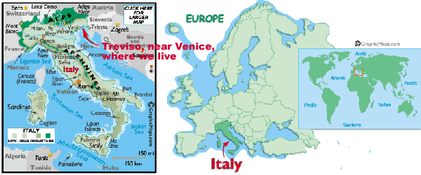
Italy
is a peninsula surrounded by the Mediterranean Sea (map
from www.graphicmaps.com)

Map provided
by Maps & World
Atlas
The Mediterranean
is the largest semi-enclosed European sea. In the north it's mostly
bordered by mountain chains
sloping steeply into the sea. The western and the eastern basin
are separated from the Siculo-Tunisian channel, that acts as a
geographical
frontier.
The Mediterranean
is one of the most delicate sea in the world. It’s 1800 Km
long, from North to South, and 3800 Km wide, from East to West,
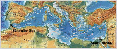
with only two accesses to the open sea, the Straits of Gibraltar,
to the Atlantic Ocean, and the Suez Channel, to the Red Sea. The
Straits of Gibraltar, that is 15 Km wide and 365 m deep, assure
a modest water change, but the Suez channel, only 190 m in widh
and 17 m in depht, is too small to permit a sufficient water mixing. Evaporation
exceeds precipitation and river runoff. This results in the water
being
saltier than in the oceans.
The main rivers are Ebro, Rhone, Po, Danube and Nile; near
their reaches the water is more fresh.
An
other Mediterranean characteristic is the “homeothermy”,
word that means “same temperature”. In fact, at the
depht of 500 m, its water has a constant temperature, around
the 12°C.
Statistics
data from
European Environment Agency:
Surface km2
|
Coastal length
km
|
Depth
average m
|
Temperature
average ·C (W-E)
|
Salinity
average ‰ (W-E)
|
2.5 million
|
46 000
|
1 500
|
15-21
|
36.2-39
|

AdriSource: EEA. UNEP/GRID Warsaw final map production |

