 
|
 Branching off Via Cassia
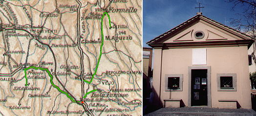 | ||
This page deals with the countryside immediately north of Rome which is in the process of being absorbed by the expansion of the residential areas. The main road crossing the area is Via Cassia which starts immediately after Ponte Milvio. At an old little chapel called Madonna di Bracciano (red dot in the 1924 map) three roads (marked in green in the map) branch off Via Cassia and lead to some locations which still give an idea of the Roman countryside in the past centuries.
S. Maria di Galeria
At Madonna di Bracciano a road leaves Via Cassia to reach Bracciano and then join again Via Cassia near
Sutri. At the first crossroad, a hedge hides an XVIIIth century fountain meant both for human and animal utilization.
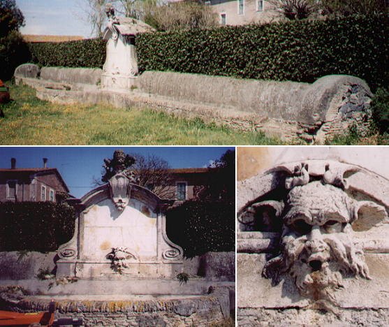 | ||
The inscription commemorates the gift of a free water supply by Pope Benedictus XIV to the owners of the land. The water came from an aqueduct bringing water to Rome. The land was owned by Collegio Germanico founded by Gregorius XIII in the second half of the XVIth century to promote Catholicism in Germany.
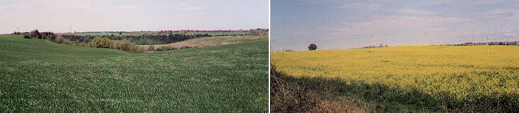 | ||
The area was owned by Collegio Germanico until 1980 and it was not split into small parcels; this explains why there are no houses in the fields, a very unusual sight in Central Italy.
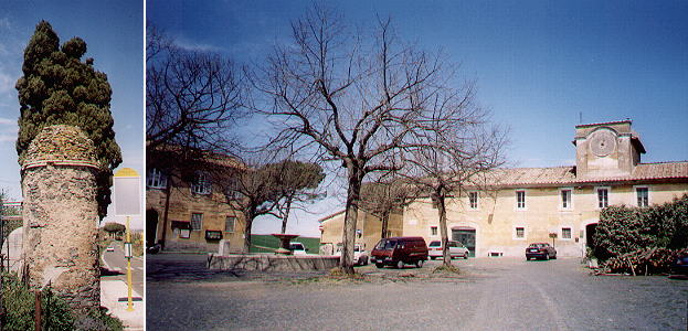 | ||
A small road on the left (flanked from time to time by columns containing the siphons of the old aqueduct) leads to the hamlet of S. Maria di Galeria from which the estate was run. The hamlet is composed of just two piazzas: the outer one has a square shape with a fountain at its centre, the inner one can be accessed only through a fine gateway decorated with a coat of arms of Gregorius XIII. To the right of the gateway the image shows the pergola of a trattoria.
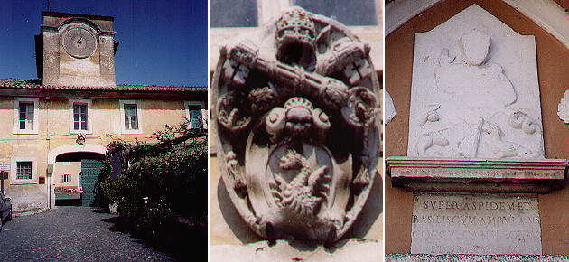 | ||
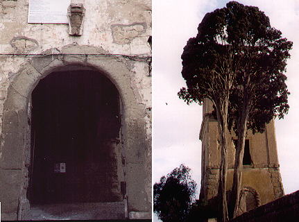
The church of S. Maria di Galeria dates back to the XVth century. The portal has an interesting although much damaged relief showing the Virgin Mary in the act of walking upon a snake and a basilisk and of taming a lion and a dragon (Super aspidem et basiliscum ambulabis, conculcabis leonem et dragonem). The basilisk, a fabulous reptile, was a symbol of lust and in the late XVth century syphilis was also called the basilisk disease.
Isola Farnese
Immediately after Madonna di Bracciano a road to the right leads in a few miles to Isola Farnese, a hamlet on a little tufa rock, which maybe explains its name (Isola = island).
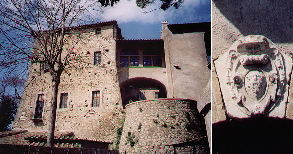 | ||
Isola Farnese belonged to the Farnese who had several possessions north of Rome (Ronciglione, Caprarola, Nepi and the Duchy of Castro). The main building of Isola Farnese served at the same time as a palace, a fortress and a farm.
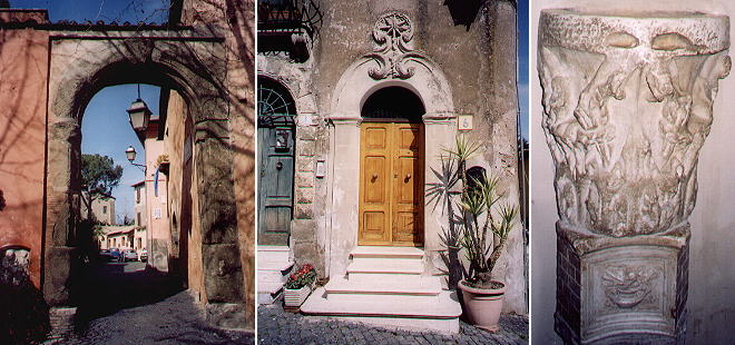 | ||
In the parish church a Roman capital turned into a holy-water stoup is a reminder of Veio, the Etruscan town seized by Marcus Furius Camillus in 396 A.D. and founded again by Julius Caesar. The ruins of Veio are scattered over a vast area below the Farnese Palace.
Formello
Another road to the right of Via Cassia leads to Formello, a fief which belonged for a long time to the Orsini and was acquired by the Chigi in the XVIIth century. The municipal coat of arms (shown in the image used as background for the page) is composed of the symbols of the Italian Republic and of the Orsini coat of arms).
 | ||
The Chigi built a palace inside the little town which is currently in the process of being restored. The villa they built a few miles from Formello and to which they gave the maybe excessive name of Villa di Versaglia (Versailles) is almost completely lost.
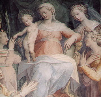 | ||
The parish church has two fine frescoes by Donato Palmieri (second half of the XVIth century). They show the typical elegance of Mannerist painting with very elongated bodies and elaborate postures. They were painted at a time when the Church was developing rules to be followed to ensure paintings and statues had a proper religious objective. One of the rules required the saints to be portrayed with a clear reference to their martyrdom. Donato Palmieri had to comply with this rule, but as he did not want to disturb the serenity of his Madonna, he put the breast of S. Agata in the lower part of the painting. At first the modern viewer believes the tray contains some sweets (see the icon of this page).
some other walks:
Walks with Ferdinand Gregorovius in the Roman countryside
In and about Viterbo
A Pilgrims' Way
In Maremma
On the Edge of the Marsh
Around Monte Cimino
From Civitavecchia to Civita Castellana
From Bracciano to Viterbo
Anticoli Corrado, where the painters found their models
A walk to Porta Furba
A walk to Ponte di Nona
A Walk to Malborghetto
Via Appia Antica from Cecilia Metella to Torre in Selci
Via Appia Antica from Torre in Selci to Frattocchie
See my Home Page on Baroque Rome or my Home Page on Rome in the footsteps of an XVIIIth century traveller
All images © 1999 - 2003 by Roberto Piperno. Write to romapip@quipo.it